
2012 USA 18-Meter Class Nationals
Dave's Blog from Montague, California
Last Update: Wednesday PM 25-July-2012
Montague is situated in the agricultural valley north of the Mount Shasta volcano, which at 14,000 feet towers over the local area. We're just a bit south of the Oregon border. East is high-desert country with a bit of agriculture. West is a line of mountains then the Scott Valley (think irrigation and sink), followed by the spectacular high Marble and Trinity mountains. Airmass incursions can come from the south (CA central valley), or from the north (Pacific marine), creating convergence zones in this valley and adjacent areas. Local weather forecasts have in past accurately identified the convergence areas which is extremely helpful, as they are often not clearly marked by cloud.
The critical decisions on each flight at Montague revolve around very long crossings between areas of good lift, and identifying convergences. Most important is the often-tasked valley crossing from the western high ground where we start every race to the eastern high ground, usually via China or Eddy Mountains on the west side and Mount Shasta on the east. An efficient crossing can be fast, but its easy to get low and waste a huge amount of time, or worse yet land at Weed airport (a strong glider magnet).
The USA Standard Class Nationals are being held concurrently with the 18-Meter class, with a total of 21 participants. Noelle and Rex Mayes (of Williams Soaring fame) are again our hosts.
I spent the morning helping a friend with some instrument problems and launched a bit late. Self-launched and shut down in a strong rotor-thermal in the blue near the airport (turned out to be the strongest thermal I had all day at a bit over 5 knots). Bases not so high off the peaks but some decent lift. Difficult to get the mandatory first turn at China Peak start as trees and rocks got in the way. Turned Scott Valley, bounced across to the beautiful Marble Mountains, and ran south along the peaks to the Carter turnpoint. Ran back north, gave up on the Wright turnpoint as I would have needed to turn it above the cloud (seemed unwise). Followed dead clouds east and managed to get low and spent a half-hour low in Scott Valley (best to get that out of the way on the practice day), prior digging out and flying a couple more turnpoints and home. Great sight seeing !
Gorgeous view climbing in the Marble Mountains west of Scott Valley.
This is Paynes Lake, west of Callaghan (
view area in Google Earth
).
Cloudbase is very close to the peaks - had to tip-toe.

This contest is the first USA contest where 100% of the pilots are equipped flying with PowerFLARM. Looks like my long campaign to bring FLARM to USA is finally coming to fruition !
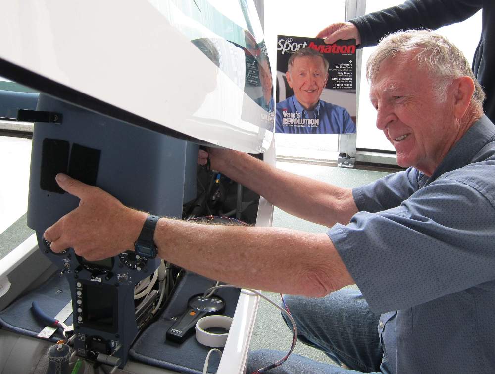
Dick VanGrunsven installing a PowerFLARM brick in his Antares 20E.
Chip is holding the latest Sport Aviation magazine
in the background with Dick's picture on the cover ;-)
Task today is an area task with turns south at China Mountain, east across the valley past Mount Shasta and east to the Radar turn, west to Carter, north up to the restaurant turn on the Oregon border, then home. Unfortunately as we sat on the grid, the top of China Mountain is still in cloud (hard to get to the turn). We need a bit more ground clearance to make this task comfortable !
Low cloudbase has the taller mountain peaks in cloud.
From left to right,
Mount Shasta with peak above the clouds,
then Eddy Mountain and China Mountain with peaks in cloud.

Task opening was delayed to let the clouds rise. Bases were up to almost 9000 feet when we started, but China Mountain peak is 8551, and Mount Eddy is above 9000. I had a good start and followed a convergence line south, (oddly west of the clouds) and watched the gliders ahead and east fall away. Bounced and weaved and bobbed to stay as high as possible, across China Mountain, to the east flank of Mount Eddy where I took a climb - only to 7500 feet. Headed across the valley following a line of wisps, but promptly got very low on the flank of Mount Shasta and had to beat a retreat back into the valley. Struggled mightily to get up and work around the north side of Mount Shasta, no markers ahead and plenty of gliders very low and behind.
Finally connected with good clouds and lift on a small peak north-east of Shasta, almost an hour after starting the valley crossing. Cloudbase is uncomfortably low; very little working band and if you get down on the deck its easy to get forced out into the valley to avoid the terrain. Good clouds along a convergence north of Medicine Lake, and I saw Chip in the Duckhawk low and behind me, and no gliders ahead, so perhaps I'm doing OK even with my slow crossing ! Played it conservative, then went a distance into the Radar turn area expecting others to turn sooner and give me some markers heading back west.
Got a bit too aggressive and didn't stay up near cloudbase, again crossing the valley a bit low. Thought I could climb the side of Mount Eddy, but it didn't work. Ooops. East side of the mountains are in shade, the convergence is on top of the ranges, and down on the east flank lift isn't where I am anyway. Ended up wasting considerable time, falling northwards til finally climbing out on a low spur of China Mountain. Worked west on top of the range into the convergence and ran south to just nick the Carter cylinder. Ran slowly north along convergence over the peaks, nicked the last cylinder and flew home for an excruciatingly slow speed.
Allan Barnes, who on practice day two went to 23,000 feet in wave in back of Mt. Shasta, won standard. Allan said he went from looking at Shasta's peak from 9,000 feet above to looking up at it from 9,000 feet below. Chip wins 18m in the Duckhawk at 73 mph. Chip crossed the valley eastward a bit south of me, making better use of the convergence, then went around the south side of Mount Shasta. I'm sure he didn't look down because he would have had a heart attack ! Anyway we made the same speed to well past Medicine Lake so that was no big advantage. Chip was more careful with crossing west, stayed up at cloudbase, and got deep into the Carter cylinder. 4 non-completions in standard class and 2 in 18-meter.
OLC shows me below ground level attempting to get past Mount Shasta - Very discouraging !
Looks blue and weaker, later developing and early shutoff. Local MAT task to run us up and down the Marbles (west side of Scott Valley), then the east side. Grid at 11:30. We'll see...
The day took a while to develop, kept getting stronger, and I started late. Took a detour to stay over high ground going out to Quartz, wasted some time. Stayed with the clouds along the Marbles to Carter. As the hills along the east side of Scott Valley were shaded by cirrus, I retraced my steps north along the Marbles well to the west of courseline. Wasted time being too conservative and staying high. Turned in a lot of foolers today - huge surge, but make a turn and you fall out the side for a net altitude loss and 30 seconds wasted searching. Again followed clouds west off course after a good climb on Cottonwood, to be sure of an easy glide to the Restaurant turn and back to sure lift at Cottonwood. Bounced south to Lefko and came home. Way too conservative and very slow again...
Peter Deane won standard, using a convergence line north from Carter direct on course, in cirrus shadow, in the blue, while many of us detoured way west to stay with the clouds on the Marbles. Newcomer Luke Ashcraft won in 18-meter, staying with the cloud on the Marbles northbound until a very high climb gave him a direct shot across Scott Valley, rest of the flight textbook. 2 non-completions in standard, everyone finished in 18-meter.
Looks a little stronger today, higher with more cloud. Task has us heading east to Radar and back across the valley to Carter.
Flat main tire while taxiing out to grid. No flying for me today - should have had a spare ready to go ! Assuming parts arrive Friday AM, I hope to fly Friday...
Sorry no report on Thursday flights (I worked on my wheel rather than attending the pilots meeting). Replacing the tire on a Beringer wheel in the field without a lot of special tools is not a good idea. Not fun. I will get a spare wheel and tire, so next time I get a flat I can quickly swap the whole assembly.
While I reinstalled my wheel assembly, I watched the sniffers get towed aloft and land back. Day canceled when it was too late.
Day canceled, risk of damaging hail and storms later...
The wash-bucket I left out says we had 1" of rain last night. We have a gradual drying trend. Too gradual. Clouds are very, very low. We will stage at noon and wait to see if cloudbases rise to a level for a task. Ultimate CD-wimpout task sheet has two possible MAT tasks, each with a single turnpoint, in opposite directions...
Mandatory first turnpoint Quartz is in the Scott Valley near the north end of the Marble Mountains. As we watched the day develop the Marbles looked good, but with clouds just above the peaks. If it heats up and cloudbases rise just a bit...
To get a good view of where the clouds were developing, I stayed low for a while before the start. The Marbles looked better and better, so I started, bounced a line of clouds across Quartz, and headed into the hills. It was a bit slow getting up onto the high ground where the good lift and clouds were sitting. Had to take weak climbs to gain a few hundred feet, move a bit into the peaks and take a bit better climb. Cloudbase was just over the peaks, not much headroom. Despite 6-7 knot lift under the best clouds, couldn't really cruise fast as there wasn't enough space to accelerate to cruise speed...
Absolutely stunning scenery in these hills. I went south to Carter, north to Wright Peak, off the hills to Quartz, three laps. Last lap I knew I'd be way overtime but just had to take another run over this amazing scenery. Last lap I couldn't get to within a mile of Wright Peak as I was too low and well below the turnpoint, so I got within 2 miles for a penalty and turned when the trees were in my way. Stayed out too late and had a slow climb out of Scott Valley to final glide altitude, and landed at around 7PM. Speed around 60 mph, but turnpoint penalty or dropping last turn takes it down to 57 mph scored.
View towards the Carter turnpoint as I topped out.
Tight ground clearance meant strong lift didn't permit
fast cruise except for short stretches of streeting over the peaks,
as in the segment ahead into Carter.
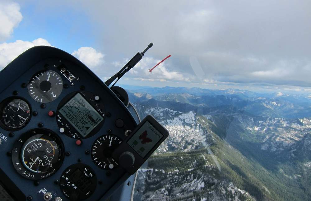
Scenery in the Marble Mountains on day 4.
This is Lower Wright Lake, just below Wright Mountain peak
(view in Google Earth)
.
Some poor bugger saw me circling and followed me in here low,
but I was circling in sink to get this picture (sorry).
I was much too close to the terrain to take pictures for most of the day.

Big variations in speeds today and one landout. Lots of pilots had trouble falling off the Marbles and taking a long time to grind out of the Scott valley.
Phil Gaisford won standard class at 68 mph with a few trips along the Marbles. Phil fell off the mountain peaks and got a save near Callahan, but otherwise avoided wasting too much time and stayed high. Looks like Wright-Carter-Callahan may have been the fastest loop, faster than coming off the Marbles to Quartz and then taking a lot of time to get back high on the Marble's peaks.
Gary Ittner surprised everyone by going east, which is where he thought everyone else was headed after the first turn. Gary was wondering why he never saw any other traffic on his PowerFLARM... and he won the day at 77 mph. This despite the very low ground clearance, as despite the forecast the clouds were no higher to the east, and the ground is a lot higher.
Looks hotter and higher today, with winds building later. Water vapor loop shows really dry air for today. Maybe blue to the east. 3.5 hour TAT, or maybe task Zulu ? What's this Zulu business ? Well, original task is over serious boonies and perhaps there will be no clouds there and perhaps the lift won't be very high...
In the air our task is changed to Zulu. MAT with mandatory turnpoints China Peak and Three Sheds (across the valley and well north east of Shasta). After that we make up our own route for 4 hours target time.
Before start I saw odd wisps, so I poked around looking for wave or convergence. Presently a bunch of us were well above the clouds in convergence thermals over 10,000 feet. These thermals kept reforming in different spots along the convergence and not everyone got high. Ray Gimmey started early when he got to 10,000 feet but I figured it was still developing and wanted to see a bit more development down by China. I've been stuck on China flank unable to get up to the turnpoint too many times.
Started around 2PM from 9,500 and followed a weak convergence line down towards China. Gary Ittner in P7 marked a thermal which got me high enough to connect with clouds on China flank. A bit of a detour to the clouds but I arrived at the turn just under Gary. There's a bit of a convergence line across the valley to Shasta, but no good lift. It looks like the convergence might work around the south side of the mountain but that's way off course and too frightening. Gary proceeds around the north flank of Shasta while I wimp out and head a bit south and take 3 knots to get a bit higher. The terrain around the base of the mountain is pretty flat, the lift is close to the mountain, and things get ugly in a hurry if you don't find lift, or even uglier if you hit sink. OK, I'm a wimp...
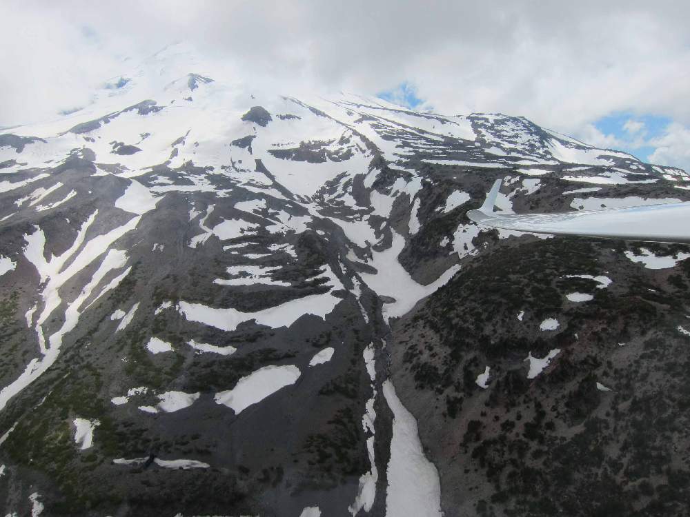
Gently bumping around China, the convergence line is well south and off course, but I follow the lift and stop to take pictures of the eastern slope of the volcano before heading east under the clouds. The detour paid off and I had a high easy run following a convergence line and street to the Three Sheds turn. Gary went direct over Whaleback peak but I think we got to Three Sheds at about the same time.
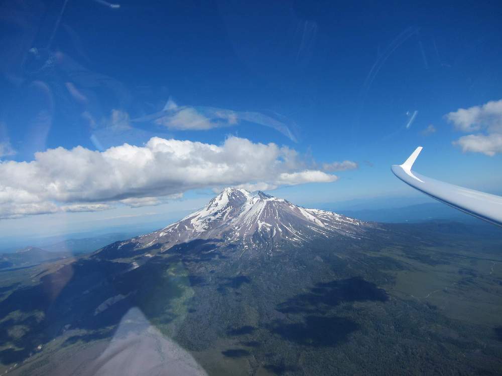
East flank of Mount Shasta volcano.
Photo taken while climbing under the convergence of marine
air from the south hitting the high desert airmass.
It looked to me as if the convergence street ran north up towards the Radar and Worden turnpoints, so I headed that way, only to have the clouds dissipate as approached. Aaarrggg... Turned Worden, followed the small hills in the valley back towards the clouds at Three Sheds, and was joined in a thermal by Ray Gimmey in 7V - Ray got suckered up there too. This was an unfortunate blunder - wasted at least 10 minutes. Anyway, after a brief struggle we were both back up with the clouds.
A monster street has set up along the convergence line, so now the game is pick three turnpoints that allow multiple laps along this convergence. We need turnpoints not too far off the street and far enough apart so we don't run out of our 11 turnpoints in 4 hours. After frantic map juggling and computing I choose Longbell, Deer Mountain, and Three Sheds. Three screaming laps featured 11,000 cloudbase, thermals as strong as 10-11 knots at peak, and a continuous line of lift along the center-line of the convergence. A great day to be flying the Antares 20E-18 at 11.5 lbs/ft2 ! Steve Northcraft complained I passed him like he was chained to a tree-stump.
It looked like lift across the valley continued over China Peak, Callahan, and maybe even Carter. I slowed up a bit as I've got burned being aggressive and then getting stuck on the flank of China or Eddy. Bounced gently across finding only weak lift, and took a few turns in 4 knots to guarantee easy crossing over China peak. The clouds were dissipating and dreams of Carter were clearly ill-advised, so I turned Callaghan and blasted home along a convergence over Duzel mountain, finishing 10 minutes over our 4 hour target. 295 miles at 71 mph was good for 3rd today, behind Gary Ittner at 74 and Chip Garner at 73.
Steve Northcraft won standard at 68 mph, followed by Phil Gaisford and Bob Fletcher. Two land-outs today: one failed valley crossing (didn't get high enough on China prior starting across), and one up in the blue area to the east at Butte Valley airport (someone else suckered up towards Radar).
Temperatures forecast a bit lower than yesterday, with lower forecast lift strength and height and blue. No forecast convergence lines to enhance lift. Groans from the pilots at briefing... Task A is a MAT with two mandatory turns at Deer Mountain north-east of Shasta, then Three Sheds again up to the east. CD Dale Bush says "we can't condemn the day without trying", not too optimistic ! Stage at noon.
Three launches to weak lift then day scrubbed at around 2PM. A few pilots flew locally and Dick VanGrunsven managed China Peak and Dutchman.
Better weather tomorrow and Friday ! Tomorrow is the last race day... Today should be good though. 3:30 MAT task runs as along the forecast convergence lines: east across the valley out to Backscatter, back across and into the Trinity mountains to Carter, across yet again to Schonchin, then north to Radar, and home. We'll have to go 100 mph to make 350 miles and all the turnpoints in 3:30, so likely we'll not be visiting Radar. Coming home from Radar is also a bit too exciting as the direct route runs us through an interesting mountain pass. "B" task skips the multiple valley crossings and keeps us east. Maybe "B" is more likely...
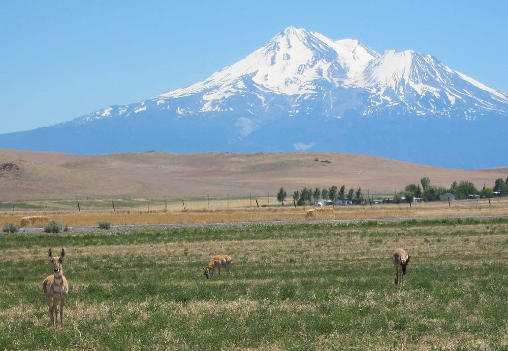
Pilot: "There are two antelope on the runway, should we hold the launch ?" Tuggie: "Nah, I'll take the one on the left and you get the one on the right." Haven't heard that before. They're more dangerous when they are next to the runway and may run towards the aircraft taking off.
Initial climb is very slow - 2 knots. It took a while for the day to build, but build it did. Convergence-enhanced thermals in the start cylinder took us high, and I started from over 11,000 feet at 2:31. Flying a bit slowly down the convergence line got me directly to the top of China peak, picking up a minute or two on on P7 who pushed harder down onto China's flank. Worked up to 11,500 foot cloudbase a bit south of the turn and headed across the valley for a reasonably painless transition around Mount Shasta into the convergence line to the east (though I did probably waste a few minutes taking a 3.5 knot climb on the flank of Shasta to ensure easy connection with the convergence line). Fast run along the convergence out to Backscatter, where earlier standard class starters marked a good thermal. Topped of and ran back east.
Slowed up a bit too much crossing the valley and running into Carter, taking a 4 knot climb over China. There were good solid cores and I should have pressed harder instead of trying to bounce along near cloudbase - wasted probably 5-10 minutes.
Easy transition back across the valley with a street almost direct to our next turn at Deer Mountain, though I again ran a bit slowly and wasted time instead of pressing hard direct to the convergence. Lift under the clouds was 8-9 knots in places to 13,000 feet ! Easy fast run to the last turn at Conchin, turned west and bumped up to a 5 knot final glide with a couple thousand extra. Final glide was none-the-less nerve wracking, with the last 20 miles mostly below 1000 foot AGL flying down a canyon. At least today the OLC display doesn't show me flying below ground level as it did a few days ago, though it shows how low I was the last 20 miles.
317 miles at 81 mph is very slow for today. Too much time being conservative to stay high, then too aggressive on final glide (should have climbed higher when I had 7 knots, before flying down the canyon).
North flank of Mount Shasta volcano.
The right (western) portion is Shastina,
which is the part of the volcano
that erupted most recently - around 200 years ago.
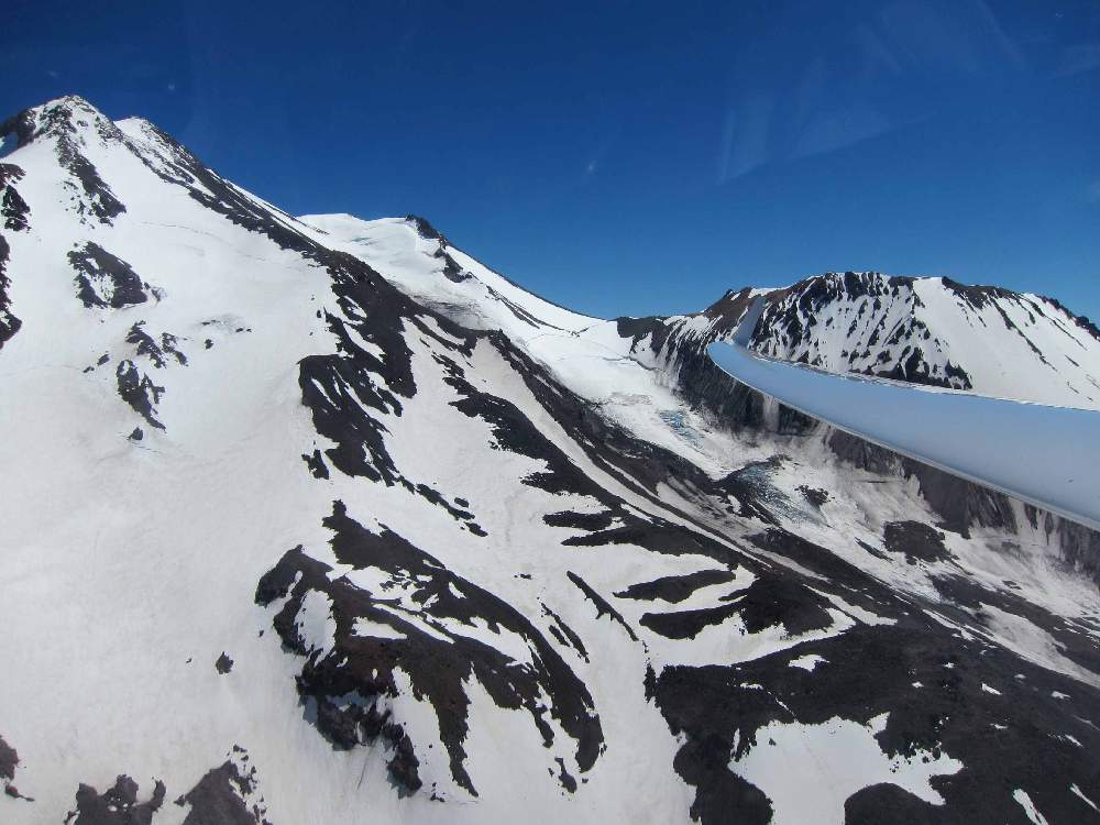
Another view of Mount Shasta's north side, for once crossing the
valley at a comfortable altitude (around 11,000 feet).
Antelopes are a regular part of the scenery at the airport.
Bob Fletcher won standard class with 81 mph. Bob started at 2:26, pretty late, but made an easy trip to China peak and across the valley into the convergence. Gary Ittner won at 88 mph and gave his typical abbreviated winner's speech: I went the same place as Bob. Gary went a little too fast on the first leg and wasted a few minutes climbing up on China, but otherwise textbook. A classic Montague racing day !
Forecast looks stronger today: higher bases at 13k-14k, a bit more cloud. Boundary layer is higher - up to 16k. Task "A" says Crater Lake, but Dale advises we're on "B" which is a 3.5 hour MAT starting with Carter then across to Dry Lake.
The clouds north developed in a beautiful line out to Crater Lake, so we're back on Task "A". 3:30 area-turn task with cylinders around Carter, Crater Lake, and Mount Shasta airport. Sniffers had trouble, one came back for a relight, and we launched - too early. Lots of struggling about and I almost managed to land out before the start (I would have used the motor for a relight). Also accumulated a load of bugs on the wings - we shouldn't launch so early as nobody will start before 2PM.
Finally, well after 2PM, things started cooking. Really strong stuff, glad I managed to keep all the water. Started out the top of the 12,000 foot cylinder ! The Marble mountains were cooking, and I followed an odd convergence diagonally across Scott Valley to the Marble street. Went deep into the Carter turn area, not sure what I would do next. Retraced my steps north along the Marbles, to an odd line diagonally across Cottonwood and out towards Crater Lake.
Of course, the cloud line didn't continue all the way across the valley, so the big decision is whether to press down the course line, or take a huge detour to the higher ground and better lift to the east. I can see wisps marking the convergence along the course line, so I go direct. Shoulda slowed up a bit more, as I needed to take a few turns here and there in 3 knots to keep high over the boonies.
I wasted some time circling in weak lift and consequently arrived at the high ground and nice street higher than necessary. Blasted up to Crater Lake, where there were gaps in the street and only moderate lift under isolated cu. But, I had to go see it, and take a few pictures !
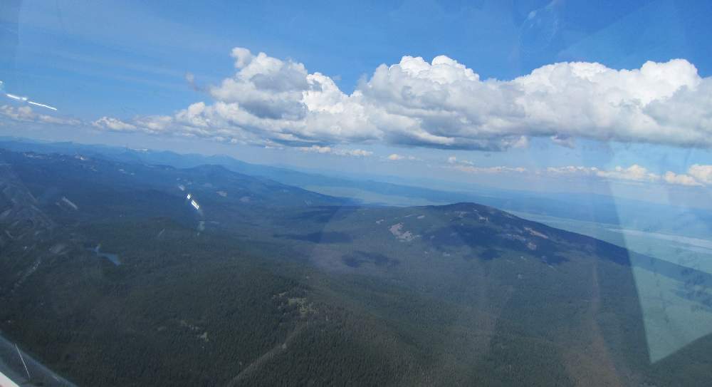
View from east of Medford Oregon.
The nice cloudstreet runs to Crater Lake towards the left.
This cloudstreet is formed by a convergence of marine air
pushing east from the Oregon coast hitting the mountains and
the drier airmass to the east.
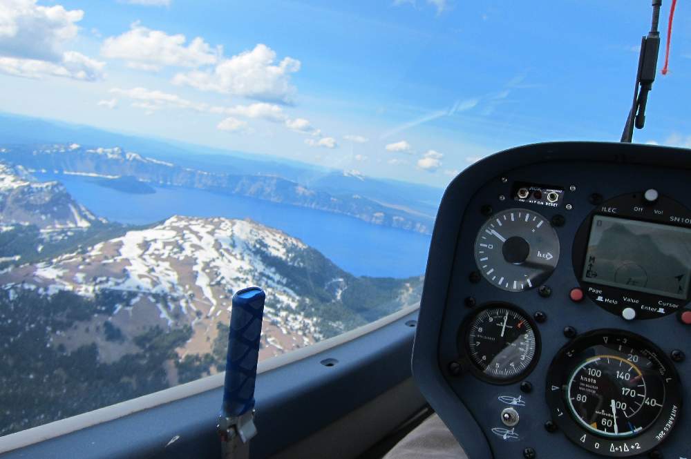
Crater Lake !
This is the first time I've seen this extraordinary sight.
OK, stop circling in junk taking pictures and get back to racing. Back to the street southbound, which is screaming. 120 knots down the middle of the black-domed cumulus. The street ends abeam Klamath Falls, so now a big decision. Left of course to the eastern convergence where clouds beckon ? Straight on course where there are tiny wisps but mostly blue ? Or right of course, back across the valley, and try hook up with the lift on the west side ? Both the left and right choices are way off course, but flying in lift generally works better...
West side looks risky. Long distance to the first clouds, maybe they don't go close to the last turn. East looks closer, less risky, but way off course. I go east, climb up and run the convergence and street most of the way back to Mount Shasta. Final glide altitude while still with the clouds, and I even bounce a solitary cumulus and isolated blue lift north of Shasta. Easy run into the last turn area, though I'm a wimp and didn't go as deep into the final turn area as I could have, too much final glide excitement yesterday ! 76 mph over 280 miles is good for fifth today, but much slower than the winners.
Chip Garner wins the day at 85 mph in the 15-meter Duckhawk, almost overtaking Gary Ittner for the 18-meter contest ! In case anyone is still wondering, the Duckhawk really goes and climbs. Gary is 3rd today and hangs onto first place by 19 points. Ray Gimmey takes third. In standard class Dave Greenhill screamed around at 81 mph to win the day. Peter Deane almost overtook Phil Gaisford - Phil wins standard class by 2 points ! Phil is flying with an ILEC SN10B ;-) After Peter, Steve Northcraft is 3rd. Handicapped scoring seems to have worked well for Standard class.
Thanks to Rex and Noelle Mayes (and Nick and Ben) for a great contest, Dean Gradwell for use of his great facility, and the large crew of tuggies, line staff, too many to list. Thanks also to Dale Bush who did a truly masterful job of tasking us to best advantage of the local weather - not easy at Montague.
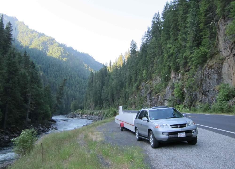
It was a great privilege to fly the two nationals at Minden Nevada and Montague California. I drove the scenic route from Montague to Bozeman where I met my wife Renee, and visited with Greg and Ursula Mecklenburg (who kindly stashed my Antares in their hangar). Renee and I spent a week touring Yellowstone, and then I completed the 7600 miles of driving this trip entailed. Now, maybe, back to work !
Early morning while driving Highway 12 through the Nez Perce reservation in Idaho.
Hope you enjoy this and please email
with questions or comments,
Best Regards, Dave "YO"
Dave.Nadler@nadler.com
Antares 20E
Electric Motorglider Information
18-Meter Class Nationals contest scores on SSA web site
Dave's Soaring publications, including blogs from past contests
Nadler & Associates Home Page