2009 USA Open Class Nationals
Dave's Blog from
Montague, California
Last Update: Saturday PM, 27-June-2009
Prologue
Montague California sits at the northern edge of California,
just south of the Oregon border and north of Mt. Shasta.
Montague is the site of this year's
USA Open Class and Standard Class National Championships; also
the local regional contest is concurrent with the first week of the nationals.
Our hosts are Rex and Noelle Mayes
(of Williams Soaring fame), with a large supporting
cast - these guys have run many contests
here before and always put on a good show.
The scenery around Montague is stunning,
and the soaring can be great,
but its a long trip for many and lacks the certainty
of great soaring weather found at racing sites like Uvalde.
This plus the current economic climate brings
a smaller field of racers than prior years,
though many of the top contenders are here.
I'm racing my Antares 20E electric-powered glider,
flying in the 20-meter configuration in open class.
This year I've even got in a bit of practice.
At the Seniors, in raw speed I had one 4th
place, one 2nd, and 5 firsts - good enough for
6th place with the Antares' massive handicap
(I'm not old enough to be an official senior
so flew as a guest). I only had two other flights
this year, both in New England, one of which
is the longest ever flown in this area at
about 450 miles:
450 mile flight on May 13th.
So, breaking with tradition, I'm almost ready to race...
I drove 3,200 miles in 4 days and 49 hours on the road,
and arrived to... rain. Dropped the trailer at the airfield
and headed to the hotel.
Spent Friday and Saturday working on ILEC SN10 software
(our USB adapter is almost ready), though some folks did
a bit of local flying between the rain showers.
The weather forecast shows a gradual drying trend
but there are no well-defined approaching fronts...
Practice Day 1 - Sunday June 14
Dawn brought few clouds and the first clear view
of Mt. Shasta. As the sun rose it was again quickly
enveloped in cloud.
After registration and the morning pilot meeting,
we had a good briefing on local soaring tricks.
Montague sits in an agricultural basin that tends
to yield no strong high thermals and is reputed
to be a site where local knowledge is crucial.
Local expert Dale Bush gave us a great briefing on all
the local hotspots used to gradually step up and out
of the valley into the higher terrain.
Dale took us outside in the warm sun to point out the
close-in peaks and thermal sources, but blow-off
had us in shade as he wound down the briefing.
The briefing ended with the usual -
Of course, we've never seen weather like this before
at this site and we're not sure what to make of it...
After debating whether to fly, I finally assembled the Antares
and took a late launch.
The sky was cycling between over-development
and rain, then clearing and sun, then lift, then ODing again.
Found a 6 knot climb under a building cloud, and headed
north towards the Oregon border and an area of clouds
not yet over-developed and raining. Found some lift in the
blue and climbed above
the clouds for a stunning and sunny view of towering
cu's in all directions. Descended and worked south
between the showers towards Mt. Shasta.
Tip-toed between showers over the higher ground and
followed clouds across the valley towards
Mt. Shasta, and eventually got right up to the north
flank of the mountain, beautiful ! Threaded back home
around the showers and got sprinkled on while
putting the glider back in the trailer.
Practice Day 1 Flight
Steady rain for many hours from dinner into the night...
Mt. Shasta
Click on the images below for a bigger picture...
Mt. Shasta from a distance, top of the volcano in cloud.
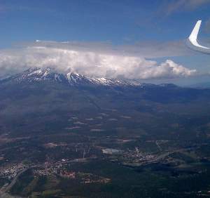
Approaching Mt. Shasta at 9,000 feet.
Top of the mountain is around 14,000 feet, a mile above me up in the clouds.
Gotta paint the insides of my air-vent diffuser ducts black to
eliminate the reflections.
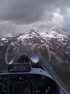
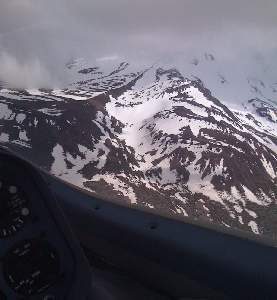
Turning up against the mountain.
Its really beautiful but this is close enough !
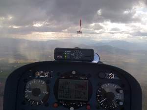
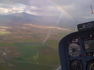
Showers on the way home, with a nice
rainbow back at Siskiyou.
Practice Day 2 - Monday June 15
Dawn arrived with low clag, puddles of water in the parking lot, aarrgg.
The weatherman says it will burn off and give decent soaring and high
cloudbases out to the east, but the mountains ringing the valley still
have their tops hidden in cloud. We'll see...
Clag burned off later, and some folks had good runs though some landed out.
Dick VanGrunsven is getting the hang of his new Antares 20E, finishing
third on the practice task after locating a convergence line north
of Shasta over to Medicine Lake.
Garret did just over 80mph staying on the convergence lines
and avoiding any slow spots.
I didn't fly (my big excitement was getting my oil changed) -
I'm well rested and ready for the start of real racing.
Race Day 1 - Tuesday June 16
Today was clear at dawn, with a lovely view of Mt. Shasta in the clear.
Unfortunately there is a lot of cirrus moving in from the northwest.
Task today is a 3 hour TAT with Craggy start, south to Callahan,
east to Medicine Lake,
north to Radar in Oregon, back south to Mt. Hebron, then home.
Radiuses of these turn areas will allow us to follow energy
lines and stay with the lift - cirrus permitting !
Heavy cirrus meant no chance of the original task.
It was rather dark !
Dump task called of 2 hour MAT down to Callahan,
north to R-Ranch, then roll your own.
I drew the short straw at front of the grid and
launched as sniffer, with Garret in H4 following.
We ground around for a very long time, weak lift,
full water. Occasional strong pulses with gradually
clearing cirrus allowing more sun and heating kept
us optimistic.
Start gate finally opened around 2PM...
I finally started 2:21, not even at the top of the cylinder.
Dribbled down south going slow and bouncing scraps of lift,
into Callahan bouncing bubbles off the low ridge into the
turn. Saw some guys down in the rocks and weeds and didn't want to
join them ! A couple circles down by the turn yielded not
much, worked back up into the high ground north-bound
and dumped the outer water tanks to climb back up.
Followed a line of lift along the hills all the way to the
northern R-Ranch turn, then back to around Badger mountain
without thermalling.
Tried to repeat the trick down to China mountain turn,
got lower than planned but still above final glide back home.
Managed to find sink, got below glideslope, headed off-course
to climb another 500 feet, final glide for sure.
Nope, almost landed at the municipal airport and finished
very low.
The low finish penalty dropped me back a few places from the 4th place
speed ! Locals informed me to avoid that
route on final glide, and after landing I was stunned to
see how many bugs I had accumulated on the wing during all the early low
rock-polishing - I had nowhere near enough performance
degradation dialed into the computer for an accurate
final glide.
Dave's Day 1 flight on OLC.
Race Day 2 - Wednesday June 17
No cirrus forecast, blipmaps not great, but its gotta be better than yesterday !
We're assigned a four hour AAT, starting south as yesterday.
That positions us to get high enough to "easily" cross the valley to the next
turns out east, where the soaring is better.
Nominal distance 261 miles, with big turn areas giving us
the option to go a lot further - or a lot less if the conditions
don't meet expectations. Only a small chance of light cirrus,
nothing like Tuesday - locals expect its going to be good !
As we stage, no cirrus, nice cu's, and an early launch around noon.
I hung around trying to get a solid climb out the top of the start
cylinder, and still started too early.
Followed the clouds down the high ground to and managed to get low
near China mountain, and was overtaken by several later starters
as I dug out.
I wanted to go deep into the first cylinder but the mountains were
almost touching the clouds and the terrain is mildly terrifying.
If I knew which canyon to fly down if things didn't work out
I'd be more aggressive here, but I just nicked the cylinder and
ended up flying north around Mt. Eddy before heading east to the
alleged good soaring.
The briefing speech
we never try to cross the valley below 10,000 ft
echoed in my head as I started across at 8,500 but
I followed a line of wisps and clouds, and got 6.5kt
in the high ground north of Shasta for a reasonably quick and easy crossing.
The cloud bases were lower in the valley and rose
as we worked into the high ground,
but while they were as high as 10,000 feet the valley floors are
5,000 and the some mountains were in cloud...
Only some of the beautiful clouds out east worked, maybe 1 in 5.
As we'd been briefed, they have a tendency hang around after
the lift stops rather than dissipating as you'd expect.
I tip-toed to near the back of the second cylinder, not very
fast but never low. Slow but easy trip back west, I followed
clouds towards Mt. Eddy intending to fly over it and into the
last turn cylinder, but I arrived at cloudbase and didn't want
to try dive over it without good familiarity with the escape
routes from the forbidding terrain to the west.
Swung north around Mt. Eddy (again !) and worked into the
high ground to nick the last cylinder.
No good looking clouds south and west and I've now used up most
of the 4 hours, so headed home.
This time I followed the high ground rather than going direct
home, which was a good thing as the wind had picked up
enormously from the north, over 20 knots gusting 25+ on the ground
as I landed.
Ron Tabery blew our doors off at 76 mph, pressing into the high terrain
for the first and third cylinders, and flying south of Mt. Shasta over
50+ miles of unlandable terrain, almost always staying high over 8,000 feet.
Ron was 8mph faster than the next finisher !
I only managed a pokey 60mph.
Dave's Tuesday flight on OLC.
Peter Deane had an epic adventure with 6 hours on task.
He got low in all the obvious places, plus many more surprising places.
Over dinner we heard of close-up views of the spectacular scenery,
lava flows, wooded high terrain, tiny settlements in the middle of
nowhere, an unlandable small airport (Tenant), cow pastures, etc.
After spending an hour low in the eastern area near Candy, Peter finally
climbed out and worked across the high ground north of Medicine
Lake though repeatedly down near the terrain, got across and
found a last thermal on the north flank of Mt. Duzel,
then determinedly pressed into the last cylinder.
Finally landed at 7PM.
Peter told us this was the most determined flying I've ever done,
and I have improbably large balls.
Views from the Antares front office.
Click on the images below for a bigger picture...
Climbing by Medicine Lake and a big lava flow.
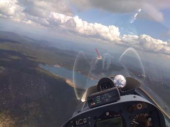
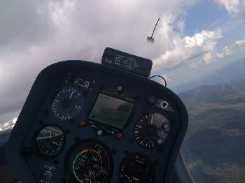
Antares panel in a nice thermal. Engine control is at base of the panel, not shown.
Race Day 3 - Thursday June 18
Much drier air, maybe blue (no clouds), higher winds,
forecast shows early end to thermals
with 10,000 to 12,000 foot thermal tops.
Task today is a three hour MAT with assigned turnpoints Callahan, Restaurant,
and China - runs us up and down the west side of the valley.
Blue at launch, but decent lift in the hills.
I started out the top of the cylinder in wave,
ran down the course a ways, but it was too early
with nobody out in front marking lift.
Marked the next strong wave/thermal lift with
GPSmark, returned and restarted using wave out the
top to a bit under 10,000 feet. Flew direct
to the GPSmark where I found Gary Ittner P7 circling
in 5 knot lift. Topped out at 9,500 wanting to stay
as high as possible prior diving into the Callahan
turn. So far so good, but there sure are a lot
of gliders low up ahead...
Tried to tip-toe down to Callahan, hoping to stay
high and get back into the higher hills without
undo excitement. Great plan but I didn't stay
in the lift line and got below the tiny ridge
by Callahan. A bit of rock polishing gained a few
hundred feet prior the lift died, turned Callahan
and headed north, shortly again below the hills.
It was rough - felt like being inside a washing machine
trying to work the blasts of hot air funneling up the
chutes in the side of the ridge, doesn't become a
nice organized thermal until well above the rocks.
Requires robust use of the controls.
Dumped the outer water tanks and gradually worked
back into the higher ground.
I was in good company with Dick Butler DB down
on the rocks, all very scenic but a bit
stressful and a big waste of time !
Higher and pressing north, the wave has moved so
I couldn't repeat that trick. Decent lift in the high
ground on Cottonwood Mountain, but there's a very long
glide out of the mountains to the northern turnpoint
north of the Oregon border and back to the hills. I flew
slowly trying to conserve height, but got back to
the mountains just at the crest and slid down
the north face of Cottonwood without finding lift,
Aaarrggg...
Finally found lift over a clearcut in the foothills
and climbed back up. Resolved (again) to try stay high
and tip-toed south this time a bit more efficiently.
I found a line of lift and reduced sink over the
hills, and flew south to the last mandatory turn
without circling. Followed the same line north,
tacked on the Lefko turnpoint in the hills,
then dove back to the finish line without further
circling or excitement.
That was really slow - just under 50mph.
Rick Walters showed us how its done at 63mph,
avoiding lots of low time-wastage, using
wave in the middle of the task, and tacking on
a few extra close-in turnpoints at the end.
Dale Kramer went to 11,500 ft in the wave before
start but didn't use it on course.
Two land-outs in Open class and three in the
Standard nationals today !
22% of the combined field landed out...
Scott Valley airport was very popular.
A terrible accident: all you can eat ribs night
at the Branding Iron is Wednesday, not Thursday !
Fortunately the proprietor felt sorry for us
mis-informed glider-guiders and we were very
well fed. Return task next Wednesday.
Dave's day 3 flight on OLC.
Race Day 4 - Friday June 19
This morning we have a lot of cloud at different levels,
and a rather confusing weather synopsis.
National Weather Service claims its going to rain in the afternoon.
We've got a 3 hour turn-area task with a lot of close-in
points, starting with Callahan because we've had
so much fun there the last few days.
Nominal distance 200 miles and min/max of 100 to 300 miles.
Despite the cold dismal morning, by launch time it looked promising.
We launched to low but reliable clouds in the hills and even in the valley.
7k cloudbase is pretty close to the terrain, but its rising as the day builds.
Early lift in the start cylinder made a text-book start seeem plausible,
but after an initial recon foray south there was no lift in the area.
It took a few tries to get high near the cylinder and make a reasonable start,
undoutedly too early.
My plan was to nick the east end of the 10 mile cylinder
around Callahan (near Mt. China),
and avoid more low fun around Callahan.
As I headed south the clouds looked terrible by China,
so after wasting some time getting high I headed into
Callahan.
Stepped clouds at the edge of Scott Valley indicated
a convergence line, and I went up the convergence
above the clouds as I headed south.
The view was stunning as I pulled above the clouds into
the brilliant sunshine, the Marble mountain range capped
with snow amongst the pine forests, rock outcroppings,
and glittering lakes up in the hills.
Its slower up here but I can't resist !
And I resolved no more circling .
Pressed into the high ground without circling,
until the end of the convergence.
Should have pressed into the back of the cylinder,
but I might have had to circle.
Turned north and followed the convergence line,
then jumped streets into the R-Ranch cylinder.
Turned south, and followed the clouds over
the high ground into the next cylinder.
An exploratory turn or two showed no strong
lift, so I turned back towards the
Siskiyou cylinder. Stopped and took my first
thermal near Gunsight, after 90 miles
of dolphin flying without thermalling.
I didn't expect that the day was going to be this
fast, and made a tactical error by not going deeper
into the earlier cylinders.
Now I have to cross the Shasta valley over Siskiyou;
otherwise I'll be under time and take a big hit on my scored speed.
While there were cu's in the valley earlier, when
I crossed there were only wisps.
Wasted time messing with 3 knot climbs to
get back up and going into the hills. Connected
with the clouds and pressed a bit over time into the
last cylinder, on the flank of Mt. Boulder - just
gorgeous scenery.
Bouncing the clouds homeward wound me up to a
MC 6+ final glide at mach speed on to the finish.
71 mph is only good for 5th place today,
but what a fun flight !
Garret smoked us at 82 mph: started early,
took a lot of 3 knot climbs to avoid getting low,
detouring up to 45 degrees to stay with good clouds,
and never getting stuck.
He spent some time ridge-soaring Mt. Boulder admiring the
waterfalls and scenery up there before getting back to
finishing the race.
A few folks got badly bit:
Peter Deane under-cooked his final glide and landed
within one mile of the airport.
Many-time champion Gary Ittner tried to come
home for a relight and landed across the road
from the airport.
And my Montague flying education continues...
Dave's Day 4 flight on OLC.
Race Day 5 - Saturday June 20
Looked great in the morning, but heavy cirrus cloud is sliding over us.
Task is out to Alturas via China mountain, but I bet it will be shortened...
We're towed to 4,000 feet over field elevation 10 miles up in the hills,
to the closest lift. The task has been revised to Gunsight start,
then China, then do your own thing (3 hour MAT). Release altitude is
almost cloudbase ! Which is a bit close to the terrain to be heading
over the mountains...
Day 5 encroaching marine air and cirrus...
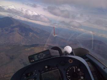
Hung out watching the clouds and hoping for a line to bounce to Mt. China.
One missed bounce will have me down in the weeds and rocks and trees and bears - again.
Started as soon as it looked possible, mindful that 3 hours are going
to bring terrific uncertainty.
The cirrus bands are alternately heavy enough to block heating and lift,
and thin enough to possibly cause overdevelopment or storms with the
moist airmass.
Days like this are always chancy.
I'll take Dick Johnson's advice, Go Early and Pray For Rain .
I try really hard to work every scrap of lift and stay high heading
to Mt. China. I can see clouds and wisps on the peak,
but there's a long gap without lift before it.
I arrive on the flank of the mountain below the peak, just under
Dale Kramer K1. Too low to connect with the bumps, I slide off
China to the east into the Shasta valley as Dale slowly grinds up the mountain.
On the east flank of the mountain well below the peak,
a clearcut yields a decent climb and I get above the mountain after
wasting 10 minutes.
Started dumping my water but Rick Walters in CW pulled in underneath me,
and its impolite to dump on your buddies.
Eventually got above the mountain and followed the crest
towards Callahan. Got low again inbound to Callahan, joined by Dale
as he exited the turn. The thermal died and I headed into the turn,
pressed past for a cloud that didn't work, and once again
ended up rock polishing below the tiny hills in Scott Valley.
I'm becoming quite intimate with these rocks, arrgggg...
After 45 minutes grinding around low, finally a good thermal takes me
up to the shelf of a building storm. I ran the storm front around a small local
triangle (Lefko, Duzel mountain, Callahan) a couple times, dodging my buddies
careening around the storm front with the same idea.
Its always spectacular running a storm front,
light to moderate rain and lightening always providing an adrenelin boost,
watching the storm progression and
taking extreme care not to get caught if the storm moves or grows.
Tacked on Scott Valley airport turnpoint at the end
and tried to tack on Grenada, but the rain was far too heavy.
Finished a bit under-time, and got the Antares back in the trailer
just as the deluge hit Siskiyou County Airport.
More good pilots got bit today. Rick Walters was under me at Mt China,
but decided to come home and try again. That didn't work.
Dick VanGrunsven got low and motored home in his Antares.
Lots of others got stuck in various places -
should further scramble the score sheet.
Not surprisingly, after being stuck low for 45 minutes,
my speed was a slow 56 mph.
Garret smoked us again at almost 73mph, once again masterfully
avoiding stepping in any holes and using the stronger lift available.
He also got low at China and slope soared back up towards Siskiyou,
intending to restart, but kept going, and improved his speed
by staying out a little overtime.
Its a tight race with Garret ahead of Ron Tabery by only
23 points.
Dave's Day 5 flight on OLC. This is an exhilarating flight on Google Earth if you are so equipped.
Rest Day - Sunday June 21
Sunday was a rest day, given 5 days of challenging flying and a poor weather prognosis.
Or perhaps I should say prognosis of poor weather lest I offend our met guy ;-)
Anyway, today I fitted my new 18-meter wingtips to my Antares 20E.
Many thanks to Dick Butler for lending some tools and his assistance bonding in the pins,
and to Garret for fiddling the heating pads to keep the temperature
up for the epoxy cure during the chilly evening (low of 40 forecast).
Now everyone wants me to fly it short span tomorrow so we can
all see how it goes - I'm curious too !
Race Day 6 - Monday June 22
Weather looks good this morning.
Assigned task of 243 miles out to the east,
first turn China to bring us across the valley
where its easier, then Dry Lake, Radar, Deer Mtn,
Medicine Lake, and return.
Oh, and the backup task is longer at 274 miles !
And, it looks like it may be quite blue, no clouds to mark the thermals...
Day 6 turned into an epic struggle.
Blue, weak thermals in the start area, but
even weaker thermals on task.
Numerous gliders fell off the side of Mt. China,
working our way down the north flank and around
the corner to the east searching for lift.
Fell off the eastern flank and headed
across the valley very low, with Weed airport
claiming a couple of gliders.
Gradually worked up towards
the pass into the high ground with a number of other gliders,
both open and standard class.
From my last climb in the hills just south of the start,
I spent 1:20 low until I finally got a climb over a highway
paving work site, where I observed the work at close hand
and saw the two hot-asphalt trucks likely kicking off the thermal
that took me just over 10,000 feet.
Unfortunately that was as high as I ever got.
Gingerly bounced across the high ground near Medicine Lake,
scraping the trees falling off towards the eastern turnpoint
at Dry Lake airport. Lots of gliders marking thermals and
climbing slowly, including Ron Tabery in SS and a few other
opens and standards. I fell behind the pack a bit, and swung
to the west of course to stay over the high ground towards
Butte Valley, periodically meeting up with Ron, and reached
turnpoint Radar unfortunately just ahead of a large gaggle.
The leg to the next turnpoint at Deer Mountain directly
crosses the large irrigated Butte Valley, and I decided
to take the route around over the eastern high ground I
had just flown over - it was still working, dark brown
hills facing the setting sun. Those that took the western
detour found mild convergence over the hills and did a bit better.
6PM and only 100 miles to go, but average speed so far is
about 30mph...
I found weak thermal and convergence, turned Deer Mountain,
and climbed to almost 10,000 feet.
Starting to look like I can finish.
Met Ron Tabery in SS in the hills approaching
the final turnpoint at Medicine Lake, but we weren't climbing,
so I slid down the terrain and eventually found
a 1 knot climb to almost 8,000 feet.
Unfortunately, the Medicine lake turnpoint is at 7,300 elevation.
I flew max LD towards the turn, and got to
within 1.6 miles of the turnpoint,
when the trees got in the way and I turned away from the turnpoint.
Flew away from the terrain and raised the electric motor...
This was a big tactical blunder.
The rules permit missing the 1 mile turnpoint cylinder by up to
a mile. I should have turned at 1.8 miles, taken the penalty,
and headed back downhill towards the convergence near Deer Mountain,
and I think I could have finished the task.
As it was, I landed at 8PM after 7:20 aloft, so it would have been pretty late, but...
Rick Walters had the same challenge as I at Medicine
Lake, turned at 1.8 miles planning to take the
penalty, but couldn't climb and landed in the valley.
We both are scored as landing near Medicine
Lake and tied for 4th place (as that is a better score
for Rick than the extra distance minus the turnpoint penalty).
We did have three finishers in open class:
Dick Butler DB won at a whopping 45.77 mph,
followed by Garret Willet H4 at 45.13, then
Ron Tabery SS at 42.
Everybody else landed out.
Race Day 7 - Tuesday June 23
Today it will be blue again.
A 3 hour area task running up and down the west side
should be a bit less trying than yesterday's marathon.
And definitely a safer call for the CD !
Turn areas will spread out the gliders a bit
on a blue day...
A 7 knot thermal in the start cylinder promised stronger conditions
then we found on course.
I started a bit late to have markers, and watched folks
climbing only slowly on Mt. China as I headed south.
Flew up the flank of the mountain and found no lift in the usual
bowls, so turned downhill and ran towards a wisp in the
high ground south of Mt. Duzel.
The thermals were strong, but my average climb was poor considering the
time spent locating and centering.
Sure could use some gliders in front marking.
Eventually got high and continued according to plan to a strong thermal
over Cottonwod Mt, flew into the first northern turn, bounced
Cottonwood heading south, and after a long glide worked
into the Trinity mountains south of Callahan.
Lift was not initially strong, but the view was stunning and
pine scent filled the cockpit.
Bowls with high mountain meadows and lakes surrounded by craggy rock peaks.
Trinity Lake came into view as I climbed above the peaks.
I took a few photos but they weren't too good
(need to get a more practical snapshot camera then my iPhone).
Reached 13,000 feet, and was tempted to try the Marble mountains
to the west of course, but it was a big detour and there was a
forest fire at the northern end, so headed back the way I came.
Dead calm above the convection for many miles, descending to
the sure-fire lift at Mt. Cottonwood - which didn't work.
Nicked the northern turn, and proceeded to slide down the hills
towards Yreka searching for lift.
Finally got up and going after wasting a huge amount of time,
then wasted more time falling below the hills pressing into the
last cylinder.
A slow but spectacularly scenic flight !
Dave's Day 7 flight on OLC.
Garret smoked us again, this time by first staying high enough
to get over Mt. China and Mt. Eddy, staying to the west
side and working the Marbles, and recognizing that the
northern area was weak and just nicking the northern turn cylinders.
Race Day 8 - Wednesday June 24
There is one forest fire nearby, with threat of others
from still-smoldering burns after the lightening
a few days back.
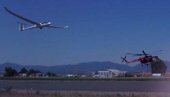
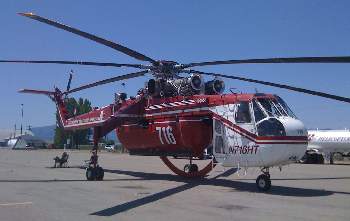
Fire bomber operations at Montague will make our operations
a bit different.
A 2,000 foot finish *may* be called,
lots of discussion at the pilot's briefing.
Its on, its off, no now its definitely 2,000 foot finish at
a 2 mile cylinder. This will definitely keep us clear of
potential bomber traffic.
Glider taking off with CH-54 water-bomber landing...
Task is a 3.5 hour MAT, with China and Tenant
turnpoints mandatory to steer us out into the eastern high ground.
Forecast calls for strong westerly wind late in the day,
some cumulus, good soaring with some convergence lines
out to the east.
Strong thermals in the start cylinder made it easy to start
out the top. I started late, and we already had a bunch of
standard class markers out in front, should be plenty
of markers on this blue day.
Left the first thermal high for an easy glide down towards
China. There were gliders milling about in weak lift
but I kept going and had an easy time getting high and
crossing in a mild shear line to the eastern hills, where
there was strong lift up to almost 13,000 feet.
Unfortunately, the gliders ahead to the east were finding nothing,
nobody circling in anything all the way across the high ground
past Medicine Lake, and a few gliders falling off into the lower
terrain to the north.
Clearly the forecast strong lift to the east wasn't happening.
I turned Tenant (last mandatory turn), and resolved not to go
east. Returned the the same strong thermal, indecisive as to
go back west across the valley and try my luck there, or
to try run north over the hills over the east side of the
Siskiyou valley, where there should be a convergence.
I milled about with Ron Tabery SS and Steve Leonard VHS
and we all took Deer Mountain and tried the north route.
Didn't work. No decent lift over these hills and I fell into the
Copco turnpoint, where there were wisps marking another convergence
line across the north end of the valley.
I was startled to see Garret down low with me near Copco,
really he should know better ! Of course he found a better
thermal and was soon above me.
Since I couldn't do anything on the east side, I followed the
convergence back west across the valley and turned R-Ranch.
Headed south and found decent lift as we had prior the start,
and continued back down to China mountain.
This time I got just above the spine of China and followed it
downhill to the east, until I got a terrific blast
from a thermal funneling up one of the chimneys on the northern flank.
The turbulence was terrific and it was a bit of a wrestling
match at first, but after a few turns I
climbed off the deck at 7,000 feet to 14,000 in 12 minutes.
Donned oxygen and reflected how much more comfortable
one is at this altitude !
The east-west shear line north of Shasta was better developed
and well-marked by wisps and cu, so I ran across the valley
from Weed to Mid-Market, then turned around and crossed back over China
and then back into the Trinity / Marble Mountains for the Carter turnpoint.
Followed the shear back to China a final time, then ran home to the finish.
Picked up a spectacular load of bugs today, dialed in 15%
performance degradation but it was even worse - certainly not 56:1 !
Again wasted time low and being indecisive so my speed was only 64 mph.
Dave's Day 8 flight on OLC.
Garret found the northern convergence prior the start, and also
realized that this ran across the Siskiyou valley to China.
After we met near Copco, he went direct to China following the convergence,
couldn't climb circling but climbed straight ahead.
Then he ran the southern east-west convergence to again
smoke us at almost 80mph !
Garret now has a commanding lead of over 350 points
going into the last day.
Race Day 9 ! Last day - Thursday June 25
Task today is a 3.5 hour turn-area task into the very high
ground south at Carter, then across the valley east to
Dry Lake, back across the south end of the valley to
Callahan, and a final turn up north at R-Ranch.
Big turn-area circles give us a lot of latitude on our course.
Fire Bomber procedures in effect again
just in case; 2,000 foot finish at 2 miles out.
Forecast is for very strong thermals.
The sniffer had trouble getting going and our launch was
quite delayed, and once airborne it was a bit slow climbing
out. By the time the gate opened things were improving,
and there was marked improvement in climb strength at
higher altitudes (not indicated by the sounding).
Wisps and clouds started developing over the entire
task area and it kept getting stronger...
I started fairly late, climbing out the top of the
start cylinder and shortly after up to 11,000 feet
over Gunsight mountain.
I could see clouds in the high mountains south
of Callahan, and resolved to try fly direct
into the high mountains without getting low
yet again around Callahan, especially as I
could see gliders milling about low on the
north face of Mt. China, far left of course.
Used a weak blue convergence line south and
took a slow (and unnecessary) extra 1,000 ft climb before getting
into the good stuff.
Once again, fabulous clouds and lift back in the Trinity mountains,
rocketed up to 12,000 feet. Turned west into the turn area and
followed the clouds, then out into the blue past the end of clouds.s
From this point I could have seen the Pacific about 40 miles distant,
but coastal California and Oregon and the sea were covered in low cloud.
Turned and followed the clouds east, with a line of cloud
marking the convergence past Mt. Shasta.
My plan was to avoid going deep into the eastern turn
area, as it had so far proved weak out in the area
near Dry Lake. There was a continued convergence line
to near Dry Lake which looked ragged and ill-formed,
so I tried a couple good-looking isolated cu on a line
further north. Worked OK but not great,
and I wasted further time climbing in weak stuff to be
absolutely sure to connect with the good higher level lift.
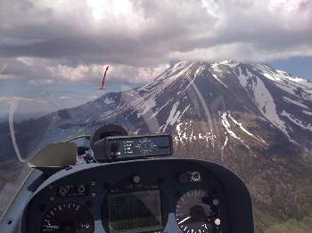
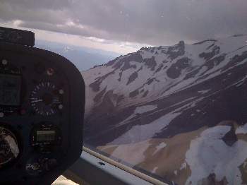
The convergence ran almost around Mt. Shasta, and I was
tempted to take the southern scenic path.
As I approached this looked like a good (or at least
not completely silly) option, and when I saw
Ran Tabery in SS head that way I couldn't resist.
Incredibly scenic view, light lift, and an easy run
around the mountain, even took some photos (below).
The clouds direct over Mt. Eddy looked ragged, so I
swung to the north and kept cruise speed slow
to arrive well over Mt. China. Arrived
well over the terrain, and the first few clouds didn't work.
Ron took the more direct route over Mt. Eddy and
saved a few minutes over my too-conservative choice.
A well developed cloud-marked line of convergence runs
back north towards our last turn, so this is going to be
a fast ride home.
Back up to the great clouds and lift, back west to the
Trinity mountains at oxygen levels, east to the
junction of the north-south line, then scream on home.
I was not able to bump and run Uvalde-style, couldn't
as accurately spot the locations of strong lift, so not
as fast as I hoped but anyway no further circling for
the rest of the run. A pokey 72mph after too many
excessively conservative decisions this last day !
Dave's Day 9 flight on OLC.
Approaching Mount Shasta from the East, then a view of the southern flank
Ron smoked us today at almost 85 mph, clinching second place for the contest.
Garret was close behind at 82mph, and in third
Dick VanGrunsven shows he knows these mountains and is getting used to his
new Antares 20E with 80.5 mph.
Epilogue
Garret wins the championship with an impressive 300+ point margin after flying
masterfully all contest,
with Dick Butler DB in third.
Yours truly in 4th place but with a meager 82% of Garret's
winning score.
Montague is a stunningly beautiful place to fly, with the snow-capped
Mt. Shasta volcano towering over the area, the beautiful
Marble and Trinity mountains, snow-capped Mt. McLoughlin volcano
and Crater Lake to the north... And a challenging place to soar.
A great learning experience ! Thanks again to Rex and Noelle,
Nelson, and the entire crew for a fabulous race.
Visit to Van's Aircraft
Dick Van Grunsven was kind enough to invite me to visit after
Montague, en route to Ephrata Washington for the 18-meter nationals.
Dick gave me the royal tour of Van's Aircraft, which was
truly impressive.
Its clear why this company is so successful:
not only are the products truly great, but they have
for decades relentlessly invested in infrastructure to support
production of kits and support their customers.
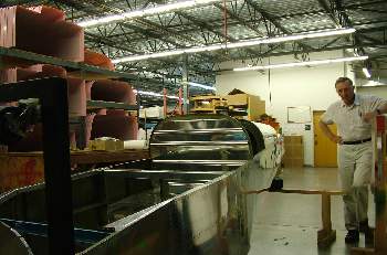
This includes the large modern physical facilities,
huge highly-automated punching machines that make the
skins, inventory management, packing and shipping, etc.
We always think of just the engineering
- we all know the engineering and staff are excellent -
but it takes all the rest to make a true success.
More than 6,000 RVs flying and more in progress is the proof.
Dick was also kind enough to take me for a ride around the
area in an RV-10, which is truly an impressive traveling machine
with wonderful manners. Thanks again Dick !
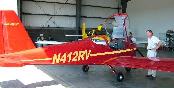
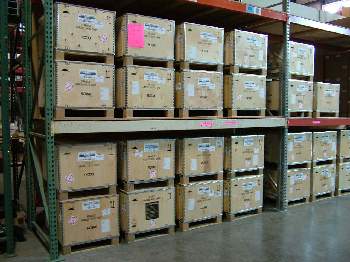
Van's Aircraft. Dick showing me some prefab components,
the new RV-12 LSA (looks much more like a real airplane than a 150),
and a pile of new Rotax 912s awaiting shipment to RV-12 customers.
Hope you enjoy this and please email
with questions or comments,
Best Regards, Dave "YO"
Dave.Nadler@nadler.com
Links for more information...
Antares 20E Electric Motorglider Information
Contest Results at SSA Site
USA Sailplane Racing Association
Dave's 2008 Blog from Uvalde USA Open Class Nationals
Dave's 2008 Blog from Mifflin USA 18-meter Nationals
Dave's 2006 Blog from Hobbs USA 18-meter Nationals
Dave's 2005 Blog from Uvalde USA 15-meter Nationals
Dave's 2004 Blog from Uvalde USA 18-meter Nationals
Copyright © 2009 - Dave Nadler - All Rights Reserved


